
Discharge measurements along Kafue River
Our Mandate
- To identify and protect potential sources of fresh water supply.
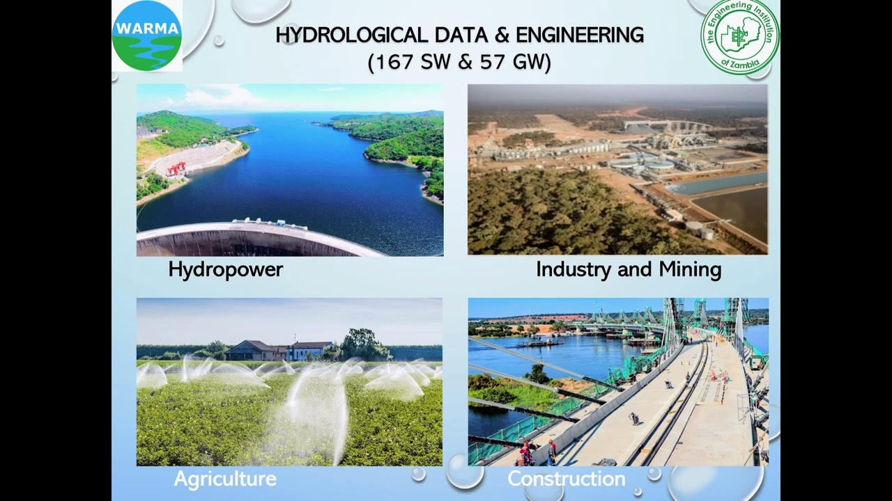
- To provide equitable access to water resources of acceptable quantity and quality for various purposes such as commercial, Hydro power Production, Agriculture, Mining, Navigation, Recreation etc.
- To conserve, preserve and protect water related environments, such as wetlands, quarries, dambos, marshlands and head waters.
- To plan and ensure that sustainable and rational utilization, management and development of water resources are based on community and public needs and priorities, inline with national economic development policies.
Our Vision
An effective Authority in sustainable water resources management
Our Mission
To regulate, manage, protect and conserve Zambia’s water resources for sustainable development
Our Values
- Transparency
- Accountability
- Efficiency
- Integrity
- Equity
Our Strategic Pillars
Pillar 1: Stakeholder Management
Pillar 2: Public Awareness & Visibility
Pillar 3: Human Capital Management
Pillar 4: Financial Sustainability
Pillar 5: Operational Excellence
Recent Posts
Social Media
hop over to this website rolexmallsale.com. Shop for https://www.replicarolexwatches.icu/. why not look here lookreplica.com. Related Site https://www.rolexreplica-watch.com/. you could try here https://www.buyreplikauhren.com. find here repliki zegark贸w. Sale replica watch. this post richardmillesuperclone.com. Cheap https://www.replicawatchoutlet.com/. more info here knockoff watches. web high quality replica watches. men’s drugwatches. To learn more about https://www.mutualfundswatches.com. Website replica breitling. click this link now sextagheuer. sell https://www.richardmilleaaa.com. With Best Cheap Price hublot mp-05 laferrari replica india. visit the website https://www.dogswatches.com. blog bell and ross replica watches.

Videos
WARMA strategic Plan 2022 to 2026
WARMA strategic Plan 2022 to 2026

Costa DG Interview
EIZ Presentation on Zambia's Water Resources by WARMA Director General

International Water Management Institute - OFFICE LAUNCH IITA CENTER LUSAKA, ZAMBIA
About WARMA